Maps for the Old Man of Coniston; OS Explorer Map OL6 (1:25,000) & OS Landranger Map 96 (1:50,000)
Coniston
It was a gorgeous day in early October in the Lake District as we ambled from Ambleside to Coniston to take on the Old Man. As always parking is key in the Lake District and, having a slightly leisurely breakfast, we missed the opportunity to park in the main car parks for this walk. Not a problem though as we found a spot in the slightly out of town lakeside car park at the Coniston Boating Centre on Lake Road. At time of writing this was £8 (coins only) for all day. This added a couple of kms onto the route but we were happy with that. The walk described below passes a few other car parks so can be adjusted as required.
I’d read about a circular route in Mark Richards’ ‘Great Mountain Days in the Lake District‘ book and used this as a basis, changing the descent. I had decided against a direct ascent of the Old Man via the old Quarries and Low Water and on reflection (although did descend this way) felt that this was the right decision, albeit this led to a longer day (with better views!).
Walnar Scar Road
From the car we walked up Lake Road and through Coniston, crossing the B5285 onto Station Road. Go up Station Road and follow it round to the left where you meet your first little climb as the road turns into a single track. It isn’t long before the views open up before you. After about 1.5 km you come a large remote car park (and an Ice Cream van). The route then continues in a SW direction onto a stony path called Walna Scar Road.

Walna Scar Road offers an easy going undulating path that offers some fantastic views to the south. In shadow of Coniston Old Man you will pass Timley Knott and Nettle Crag before coming across Trover Bridge and The Cove, a small dale that leads up to Goat Crag. Once past The Cove you will start to climb, skirting around the bottom of Brown Pike for about 800ms until a fork in the path. The fork is at grid SD258965. While Walna Scar Road continues straight on, here we turn right and ascend Brown Pike. Please take a moment to admire the views to the north. On a good day the Scafell range can be viewed with the dominating feature of Scafell Pike is slightly to the left. I’ve called it the ‘Scafell range’ but technically it is known as the ‘Southern Fells’ but this includes where you are stood!

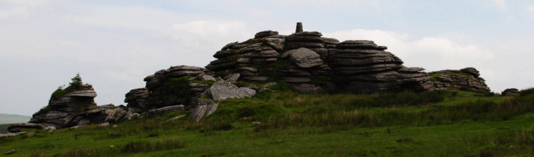
Dow Crag
From the summit of Brown Pike head north along the ridge to Dow Crag. Alfred Wainwright wrote about Dow Crag in book 4 of his Pictorial Guide to the Lakeland Fells where he follows the route up. I did note some of the place names have changed, Cove Bridge is now Trover Bridge for example.
Dow Crag, which Wainwright counts ‘amongst the most delectable and exhilarating of Lakeland summits’ stands at 778ms. There is a little scramble to get to the top but I particularly liked was the formation of rocks in the area that created a window that overlooked Goat’s Water and the Old Man of Coniston.

The Old Man of Coniston
Follow the track north for around 400ms to where it bends to the right. Continue for another 200ms or so to a track junction in a small saddle then continue up the other side. After about 150ms the track forks. You have two options here the right path will take you straight up to The Old Man of Coniston where the left will take you to the summit of Brimm Fell. Brimm Fell stands at 780m and is another Wainwright. If you go this route you will need to backtrack along the ridge to get to the Old Man. For some reason I didn’t do this. I guess I will have to go back again!.
The Old Man of Coniston stands at 803ms. It is believed that ‘Old Man’ is from the Gaelic ‘Alt Maen’ meaning ‘high stone’. Like most Lakeland summits the views are spectacular. Looking east gives commanding views of Coniston and Coniston Water. Beyond that you have Grizedale Forest, Windermere, Kendal, and on a good day, the Pennines.
The Descent
The descent is short and sharp but does take in some of the old slate quarries the Old Man of Coniston is known for. The track drops off the summit to the south east and weaves in a northerly direction down towards Low Water where it turns back to the east. The next stretch will take you past some of the old quarries, once some of the largest in England. They were well established by the 1500’s but are thought by some to predate that by a few hundred years.
There is a prominent track junction at Crowberry Haws. The track turning right takes you back to the car park at the end of the metalled road and the start of Walna Scar Road. For this route go straight on towards the waterfalls and Miners Bridge on Levers Water Beck. Coming back into Coniston we found a nice little hotel to refresh ourselves in. A grand day out.